

John Seller, A New Mappe of the Sea Coasts of England, France and Holland. 1675. © National Maritime Museum, Greenwich.
A lecture given at Emmanuel College, Cambridge, in the Cambridge Seminars in the History of Cartography series – 23rd February 2010. [This has wandered in by mistake from the companion Essays blog next door – click on the Essays tab above to find more of the same].
John Seller, Samuel Pepys and the London map-trade. Already something of a well-worn path. The principal authority on Seller, the late Professor Coolie Verner, noted – over thirty years ago now – “Much has been written about John Seller” – although he went on to add – “most of it … more fancy than fact”. Rather more has been written since, although the fact-fancy ratio probably remains constant. For those of you unfamiliar with either the fact or the fancy, let me quickly introduce John Seller (1632-1697), instrument-maker, map-maker, chart-maker, publisher of the first sustained series of English maritime atlases, the instigator of a national survey of England and Wales, the publisher of our first celestial atlas, and writer on navigation.

John Seller, Novissima Totius Terrarum Orbis Tabula. [1675].
Sir Godfrey Kneller, Portrait of Samuel Pepys, Secretary of the Admiralty. 1689.
Samuel Pepys, I’ll assume you know: the great diarist, but here in his public role as naval administrator – and a voracious buyer, collector and professional user of maps and especially charts, most of which – some 1,100 of them – still survive in his library. He knew and sought advice from the leading practitioners. He made enquiries across Europe. He studied the maps and made his own indices of place names. An expert witness, but here again, Pepys’ various thoughts on the map trade – in the diary, correspondence, minutes and memoranda – have already been exhaustively mined. Is there anything new to add?

John Thornton & John Seller, A Map of Some of the South and East Bounds of Pennsylvania in America. 1681.
Let me simply offer you a thought direct from John Seller, and his sometime partner John Thornton, on the nature of intellectual enquiry, and the perfecting of our knowledge and understanding: their map of Pennsylvania claimed to have been “Performed with as much truth, care and skill, as at present can be, leaving room for time, and better experience, to correct, and compleat it”.
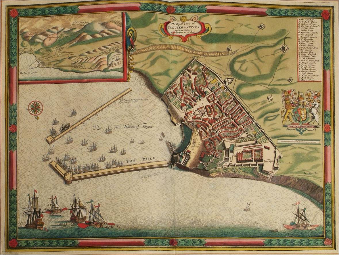
John Seller, The Royall Citty of Tangier in Africa. Engraved by John Oliver.
Pepys of course knew Seller: he bought maps from him, sought his advice, commissioned him to collect books on navigation for the library. He may indeed have known him uncomfortably well on one occasion. In 1683, Pepys sailed on the expedition to Tangier. A few days out, the weather foul, he confided to his journal: “After dinner the weather continued bad … forced to sit in little Mr. Sellers’ side cabin upon the deck all afternoon to keep me dry and not sick”. This is usually said not to be Seller the mapmaker, but the ship’s muster confirms his first name as John and describes him as a “volunteer extraordinary”. And we know, because Pepys tells us, that Seller was much concerned in the expedition, because he compiled a special platt (a sea-chart) specifically designed for use on the voyage. Why would this not be him? Why would there be another “volunteer extraordinary” of exactly that name? And the image of Pepys cooped up with Seller and trying not to be seasick over him is one I am reluctant to let go.
Because, in a way, Pepys was sick all over Seller. It is on this voyage that we first hear the central charge, the crux of this long-standing accusation of dishonesty and plagiarism. It was en route to Tangier that the military engineer, Thomas Phillips, tells Pepys that Seller had produced his first maritime atlas, the English Pilot, from “old worn Dutch copper plates” bought “for old copper” – for scrap – and had simply issued “the very same platts … without a Dutch word so much as altered” in his “pretended new book”.

The London edition of Lucas Waghenaer, The Mariners Mirrour. 1588. “Thence to my bookseller’s, and found my Waggoners done. The very binding cost me 14s., but they are well done, and so with a porter home with them” (Samuel Pepys, Wednesday 22 July 1663).
But this is to jump ahead, we need to go back to the beginning to understand the context. Pepys became secretary to the Navy Board in 1660. His experience was limited and he chides himself early on: “I do perceive that I am very short in my business by not knowing many times the geographical part”. But he was a man of method, “no man in England … of more method” reported one contemporary, and he learnt quickly. He employed a man he called One-Eyed Cooper to teach him the rudiments: “I made him to show me the use of platts, and to understand the lines … to my great content”. And he began to acquire maps and charts.
Most of those on sale in London in the early 1660s were produced overseas, mainly in Holland. Very few maps at all were being made in England and this was especially true of sea-charts. Here, the Dutch had an almost total monopoly. This situation dated back to Elizabethan times: the only maritime atlas as yet produced in England was the 1588 Mariners Mirrour –the Waghenaer atlas. In its Dutch, Latin and English versions (Pepys eventually acquired all three), it had an almost unassailable authority, to the extent that, in England, all maritime atlases were simply known as “waggoners”, whether the original Waghenaer or later Dutch derivatives. There were no English derivatives, except in that the Dutch produced English-language versions – significant numbers of them – to supply the English market.
Where might Pepys buy maps in London? In the early 1660s, there were the three leading print-sellers – Peter Stent, Robert Walton and Thomas Jenner, who stocked maps as well as prints – Pepys certainly bought maps from Jenner – but maps were not a major part of these businesses. Let’s follow Pepys a little further afield.
Nicholas Comberford, [East Indies]. 1665. Manuscript. Vellum mounted on two hinged boards. © National Maritime Museum, Greenwich.

John Thornton, [England, East Coast, Spurn Head to South Foreland]. 1667. Manuscript. Vellum, mounted on two hinged oak boards. © National Maritime Museum, Greenwich.
A similar establishment, again near the Tower of London, was that of Francis Cossinet. He published books on navigation, including Timothy Gadbury, “The Young Sea-Mans Guide”, in which he stated that he stocked “plats, cards, maps, [and] globes”. There was only one globe-maker in England at this time (we come to him directly), but we assume that Cossinet also was selling mainly Dutch material – another “Duch shop”. And in the 1660 edition of the Gadbury book, we find our first printed mention of John Seller: this is the world he came from. Gadbury describes all the various nautical instruments and notes, “all these … you may be furnished withall at the first and second hand by John Sellers compass-maker, at the sign of the Mariners Compass and Hour Glass, at the Hermitage Stayers in Wapping”, and, although he does not quite make this explicit, he had just remarked a few lines earlier that ‘instruments’ naturally included “plats for all places … as also cards and skins and Waggoners”.

John Seller, A Draught of Bombay. © Bibliothèque Nationale de France.
John Seller at the outset of his career, already with a reputation as an instrument-seller, and perhaps also selling platts and Dutch-produced waggoners. We tend only to think of Seller in terms of printed charts, but let me show you this: a Thames-School manuscript chart of Bombay – by John Seller. This one undated, but there are two similar ones in the same collection, both dated 1684. 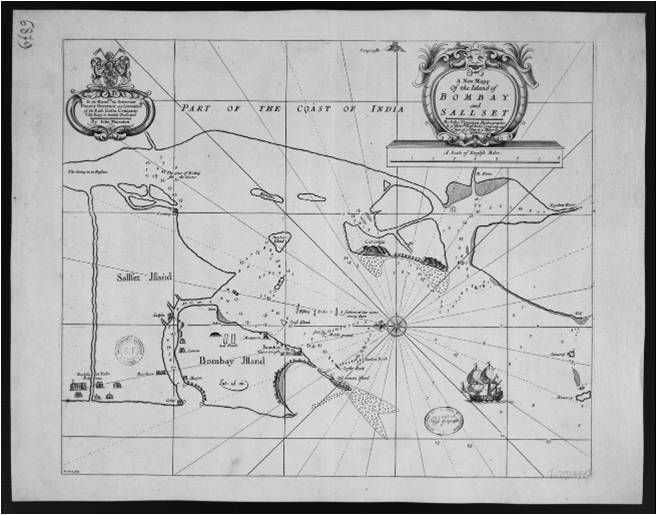 This must be an approximate date for this chart and it probably relates in some way to Thornton’s printed chart of 1685. The possibility certainly exists that Seller wasn’t the intruder into the chart trade he is sometimes portrayed as: “not a recognized platt-maker” in Verner’s dismissive words, but did in fact have some Thames School training.
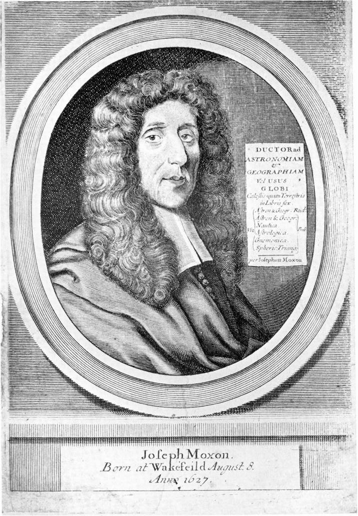
Joseph Moxon (1627-1691).
We were following Pepys in his quest for “good handsome maps”. He met none: no Dutch shops? – or no Dutch maps? It isn’t clear. But then he went back to town, to Moxon’s – it was too dark to see anything, but I said just now that there was only one English globemaker, and this was he: Joseph Moxon.
 Moxon had trained in Holland under his father, a puritan printer. Returned to England, initially as a printer, he began to study maps and globes and by the 1650s was retailing and starting to produce both. He published “A Book of Sea-Plats” in 1657 – just six charts, reworkings of Dutch material, but the first English attempt at this kind of thing since Elizabethan times, a precursor of what Seller was later to do. Pepys seems not to have bought these, although he may have had a set and later disposed of them as better and more recent material came to hand (as was his custom), but Pepys certainly bought globes from Moxon, both for his home and for his office – and was delighted with them.
In 1662, Moxon petitioned the King, “your petitioner with great industry, travell, and expence, hath found out ye perfect way of makeing globes, sphears, mapps, and sea-platts” and now seeks “to benefit his native country with ye most exact and perfect waggoner in the English tongue … so much necessary for our English seamen”. He asked for royal encouragement, which was granted, and Moxon was sworn in as Hydrographer to the King, “for the making of globes, maps and sea-platts”.

Joseph Moxon, Americae Septentrionalis Pars. 1664. The first printed map to name New York and the new province of Carolina.
He clearly intended a full-scale maritime atlas – but this is the last we hear of it. His output of maps and charts from this point actually seems rather meagre. This may of course be deceptive, survival rates are extremely poor. His map of North America survives only in a single known copy. His later wall-map of the world survives only in fragments – and this is true of some of Seller’s output too, large wall-maps that we can’t know or judge because they no longer exist.
We note the prominence that Moxon gives to London in his imprint – it was still a rare thing to produce work of this sort in London. But Moxon’s career at this point was severely interrupted, as was that of every Londoner: the Great Plague of 1665 and the Great Fire of London in 1666. Moxon lost his premises on Cornhill and probably his stock as well.
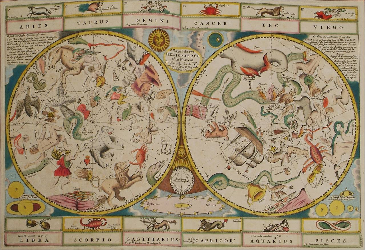
John Seller, A Mapp of the Two Hemispheres of the Heavens.
Seller too would have been disturbed by plague and fire, although the fire didn’t reach Wapping and his stock and premises would have been safe. But he did experience a wholly life-changing event. This is something of a digression, it seems not to relate to the map trade at all, but it’s an extraordinary and little explored tale. One of the most baffling and wholly unexplained things about Seller, is that, in late 1662, at the age of thirty, already in a solid way of business (he had just taken on his third apprentice), he was taken into custody and arraigned on a charge of high treason.
Pepys gives some background: “All this day, soldiers going up and down the towne, there being an alarme and many Quakers and others clapped up”. Hundreds were arrested. Pepys is sceptical at first, but later says “for certain, some plot there hath been”. He even dreamt about it one night. The outline was that a conspiracy had been put together by an alliance of dissident factions – the “satanical saints”, “fifth-monarchy men, anabaptists, independents, fighting quakers”, levellers and presbyterians too. The aims, apparently agreed by a secret council of six, were armed insurrection, the assassination of the king, the overthrow of government and the setting-up of a free state.
Most of those arrested were soon released, but some, including Seller, were brought to trial. Coolie Verner’s brief summary was that although Seller was a friend of the conspirators, he wasn’t involved in the plot and that there was “testimony that clearly indicated his innocence”. There was actually no such thing.
The trial took place at the Old Bailey on 11th December 1662: six men in the in the dock – Thomas Tonge, a distiller, a “strong-water-man” and tobacco seller, former captain in Cromwell’s army; yeoman George Phillips; Francis Stubbs, a cheesemonger; James Hind, ship’s gunner; Nathaniel Gibbs, felt-maker – and John Sallers, compass-maker. The charges are put:
Hind, the gunner, immediately knelt before the court: “I am guilty, and humbly beg mercy of His Majesty” – but the rest plead not guilty.

Wenceslaus Hollar, Byrsa Londinensis, vulgo The Royall Exchange of London. 1644. Hollar later engraved maps for Seller – and Seller later had premises at the Exchange.
Much of the action had taken place here at the Royal Exchange. The principal witnesses were William Hill, a government informer, and Edward Riggs, seemingly a conspirator granted immunity for his testimony. Hill infiltrated the plot early on – he was introduced to the plotters on the New England Walk at the Exchange. He describes the talk at various meetings – troops at Windsor and the Tower suborned, large numbers of sympathisers primed and ready, a secret arsenal of weapons in Crutched Friars. Seller wasn’t present at any of these meetings, but Hill testifies that he and Riggs met Seller on the Exchange (where Seller was subsequently arrested). Riggs told Seller that Hill was looking for guns for thirty new recruits – and Seller told them that five- or six-hundred had been distributed the previous night, but more were arriving and Hill would be supplied.
Seller vehemently denied this, although admitted discussing a rumour about the guns with Riggs. He cross-questioned Hill: When was this? Who else was there? He denied ever meeting Hill, but Hill counter-claimed that he was the one who pointed out Seller when he was arrested – and certainly knew him. Seller denied this too, “it was not he, but the other in white cloaths, that came and took me, that knew me”.
Riggs was a little vague: he broadly supported Hill’s account, but could not remember specific numbers being discussed, and couldn’t say whether Hill was in a position to overhear or not. This is key. Sir Orlando Bridgeman, the chief justice, explained two critical points of law: firstly, that two witnesses were needed – this is why Seller was so keen to discredit Hill, because on his own admission he had discussed the guns with Riggs on more than one occasion. And secondly, that “though a man be but present when treason is spoken or designed or acted, if this man be present, and shew anything of approbation, his concealing of it is as much treason as he that did it”.
Seller was questioned from the bench: “Pray, what made you so busily enquire after arms if you were not concerned?” The eventual summing-up was damning. The jury took only an hour – all the accused guilty.
Seller responded, “I delivered no arms, if I had known where they had been, I would have discovered them, I begg mercy from the King”. To which the only answer was the chilling “Tye him up, executioner”. There could only be one sentence. Eleven days later, four of the six were put to death. At the scaffold, they all admitted complicity. Hind, the one who had pleaded guilty, wasn’t executed – and nor was Seller. I don’t know why. We can only speculate. It’s not hard to see why the jury convicted, but perhaps there was some doubt after all over Hill’s evidence and there was nothing else really to connect Seller with the others. By April the following year, he was released on bail, petitioning the Duke of York about his pardon. Later he petitioned the King to remit the accustomed fees for this, being in “impoverisht condicion by reason of his long restraynt … being thereby reduc’t to extraordinary exigencyses, for the mayntenance of his wife and foure small children … and still under conviction of that horrid cryme which his soule abhors, lives a languishing dying life”.
I don’t suppose we shall ever know the full story, but we sense that from here on Seller was a man in a hurry – and one desperate to prove his loyalty. And it may well be that in this bizarre way he first came to the attention of the King and the Duke of York, who were later to back him so steadfastly in his enterprises.
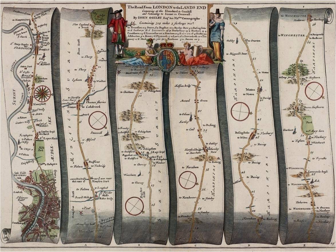
The road westwards from London, as shown in John Ogilby’s Britannia, 1675.
His business recovered, he took on two new apprentices in 1666 and began to publish books on navigation. The map trade – post-Fire – was changing. Despite, or perhaps, because of the Fire – all that stock and libraries lost – there was an upsurge in interest. The booksellers John Ogilby and Richard Blome (and Ogilby had certainly lost everything in the Fire) announced new schemes for publishing English-made atlases. They went on at least partially to realise these schemes. In Ogilby’s case these wonderful road-maps and the great map of London, published in 1675 and 1676. Moxon’s former apprentices, Robert Morden and William Berry, both first appear about this time and both became major figures, as did another young mapmaker, Robert Greene, who later coloured maps for Pepys. New talent, new ideas and fresh ambition were beginning to emerge.

John Seller, Practical Navigation : or, An Introduction to that Whole Art. Originally published in 1669, but here in a later edition. It remained in print until 1739.
And Seller joined in. In 1669 he published his own text-book, “Practical Navigation”, of which a modern editor has written, “As an instrument-maker and teacher of navigation it might be expected that Seller’s description of the various navigational instruments and of their use at sea would be exemplary and, within the limits of contemporary practice, so it is” (Michael Richey – 1993). In the book Seller advertises not just instruments, but also “plats and charts for all parts of the world … globes and maps of all sorts … English waggoners, and charts of his own making, by him new corrected and published, with other new books describing the sea-coasts round the world” and, moreover, “I intend, with the assistance of God, and am at present upon making (at my own cost and charge) a Sea Waggoner for the whole world” – the first intimation we have of the “English Pilot”.
 The first volume was ready by 1671 and Seller in his dedication to the Duke of York reiterated the old reliance on Dutch material: “we must see no further than their books direct us, nor how to avoid a shelf without a forreign pilot … none hath hitherto undertaken it … I thought it my duty, for the service of my countrey, to adventure on this great charge and trouble”. Although admitting that the work “hath the similitude of their [Dutch] Waggoners, which in all respects cannot be avoided, yet I have not made them presidential … but have principally observed, throughout the whole work, the informations and instructions of our ancient and modern navigators, to some of whom I am greatly obliged for the readiness in imparting what their own observations had acquainted them withal, and doubt not but it will be the continued practice of all ingenious mariners, still to communicate towards the perfection of a design so useful and necessary”.
The King immediately issued a proclamation in effect granting Seller a monopoly on all such productions for the next thirty years: “We … strictly prohibit and forbid all our subjects … to copy or counterfeit any of the maps, plats, or charts … and that no such books, maps, charts or plats … be imported from beyond the seas … as the persons offending will answer to the contrary, not only by the forfeiture of the said books, plats, charts, or maps, but at their utmost peril”. A sweeping privilege and one which may have fuelled some resentment. There may have been some only too keen to blacken Seller’s name.
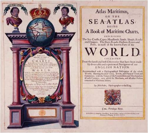
The Atlas Maritimus 1675.
Two days later, Seller was sworn in as Hydrographer to the King. A second volume of the English Pilot was published in 1672, and Seller’s instrument business was also flourishing. In the same year he applied for a contract to supply the navy at Chatham with compasses and glasses, which was granted. And in 1675 his Atlas Maritimus was published, “Which with all other of my endeavours, for the promotion of the publick good of my countrey, in designs of this nature in maritime concerns, I commit to the favourable censure of the judicious, and subscribe my self, Gentlemen, Yours to serve you and my country, John Seller”.

John Seller, A Chart of the South-Sea. [ca. 1675].
I hear an echo of Seller’s words from the dock at the time of his trial: “I would fain know, whether the bench and jury are satisfied with this evidence”? – a question that reverberates, Seller then on trial for his life, and now for his reputation.
There was certainly some inescapable truth behind the charge. Seller did acquire sixty or so Dutch printing plates to form the nucleus of his endeavour, and some of the earliest do look a little scratchy and improvised. But was there another or a better way to start? By common consent the Dutch made the best charts and these plates weren’t in any meaningful sense obsolete: they were plates published in his lifetime by reputed makers like Jan Jansson and Jan van Loon, later on supplemented by brand-new maps by Frederick de Wit. It was in any case Pepys’ own view that all these seventeenth-century Dutch charts “borrow all from Waggener” and that this remained the case “till Seller fell to work and made some improvements therein”. And in terms of revising and updating material, Seller undoubtedly had access to the very best existing sources, including a copy of Robert Dudley’s legendary “Arcano del Mare”, which Pepys was anxious to borrow from him at one time.
The supposition that Seller travelled to Amsterdam and somehow stumbled across obsolete plates being sold as scrap metal is, I suggest, somewhat ridiculous. Let us look into the detail. When Phillips and Pepys were discussing this, they had a Seller atlas of some sort in front of them: “Seller’s book in 1668” is precisely what Pepys says. But what was this? The first volume of the “English Pilot” wasn’t published until 1671. Verner constructed an elaborate bibliographical argument for there having been an earlier and now lost 1668 edition, rather ignoring Seller’s statement in 1669 the work was “at present upon making” and indeed the royal proclamation of 1671 that the work was now finished.
Let me suggest an alternative hypothesis. Seller was importing Dutch material – possibly as early as 1660, certainly by 1669, when he advertises “charts for all parts of the world” and “English waggoners”: these latter are plainly not the same as his own waggoner which was still “upon making”. They can only have been Dutch-made English-language atlases. Is it possible that what Pepys and Phillips were actually looking at was not a lost edition of the “English Pilot”, but an imported Dutch English-language atlas with an inserted Seller title-page? No such thing survives – just as lost as and improvable as the hypothetical 1668 “English Pilot” – but at least we have a precedent, the Lugger atlas, and Seller was plainly stocking something very like it. This would make more sense of Phillips’ words – charts “without a Dutch word so much as turned into English”. Why would they have? – they were Dutch productions. Were Phillips’ strictures founded on a basic misapprehension?
I don’t know, but this gives us a far more plausible route for Seller acquiring his Dutch plates – in the normal course of his trade. Did he simply say to his suppliers of charts and waggoners, why don’t I buy some plates from you?

Michiel Comans, [Dutch Attack on the Medway]. 1667. The Dutch fleet passing Sheerness, British vessels in flames off Rochester.
What of the charts themselves? However Seller began, by the time the “Atlas Maritimus” was published in 1675 – the collation is unstable, there are endless variants, but of the forty or so charts, more than half were brand-new – engraved for Seller in London by local engravers. And, as Pepys also records, before too long the Dutch were copying Seller: Joel Gascoyne pointed this out to Pepys at the time.

John Seller, A Chart of the North Part of America. [1673?].

John Seller, A Chart of the Coast of America from New found Land to Cape Cod. [1674?].

John Seller, A Mapp of New England. 1676.
I accept that North America may be a special case – Dutch material was less plentiful, English interest rising fast (and we may care to speculate about Seller being so frequently on the New England Walk of the Royal Exchange at the time of his trial) – but I think the case is sufficiently made that Seller was rather more interesting and original in his work than some would allow.
By 1677, Seller seems to have made good headway in preparing charts and text for further volumes of the “English Pilot”, but then something happened. In his preface to one of the new volumes (The Mediterranean), he announces, “Here I thought good publickly to advertise the reader, that for the better management of my so chargeable and difficult an undertaking, I have accepted the assistance of my worthy friends, Mr. William Fisher, Mr. John Thornton, Mr. John Colson, and Mr. James Atkinson as my copartners in the English Pilot, Sea Atlas, and in all sea-charts”. He shares out the enterprise, principally with Fisher and Thornton. And two years later there was a further re-alignment: broadly speaking, Fisher took over the rights in the completed works, Thornton in those still to be completed, and Seller retained his existing stocks.
This is invariably interpreted to mean that Seller was in severe financial difficulties, bankruptcy looming, and that he was compelled to take on partners and then release his rights. Quite what the evidence for this is, I am not sure. Seller still had his contract to supply the navy with compasses. He was still taking on apprentices, seven more in the 1670s, and he was just about to embark on another and even more expensive exercise – hardly the action of a man in desperate financial straits. But he had been working all out on the project for a good few years and may genuinely have needed assistance. He may have felt he had taken it as far as he could go – time to hand on. There may have been practical issues of handling and distribution. Or, he may simply have grown tired of the sniping and set out to prove a point. This is what he did next.

John Seller, Kent actually survey’d and delineated. Originally published in 1681 as part of Seller’s “Atlas Anglicanus” project, and here in a later, early eighteenth-century edition, with revisions by Herman Moll.
He now issued proposals, in partnership with the surveyor, John Oliver, and the engraver, Richard Palmer, for a completely fresh survey of the whole of England and Wales – the first since Elizabethan times. “Having consulted all mapps already extant, and finding so great a deficiency therein, we thereupon thought our selves … obliged to undertake this great and elaborate work”.
Pepys applauds – “very good matter” – as does the King, who still seems wholly to approve of Seller’s work so far, and in 1679 allows the partners the duty-free import of paper. The work, already begun, proceeds apace. By the end of 1681, seven maps (London, and six south-eastern counties – by no means the whole country, but a large swathe of it) have been produced. And then the project dies. This time, I suspect that the money really had run out. He had driven himself to the brink in the service of his country.
There seems to be a puzzling absence of contemporary comment. Pepys says nothing and nor does that other seventeenth-century diarist, Robert Hooke, the scientist, and, like Pepys, a serial buyer of maps who knew everyone in the map trade. Hooke had helped Ogilby greatly on the road maps and was frequently in company with Robert Morden, William Berry and others. When Robert Greene set up shop in 1675, Hooke was among his first customers. A witness we would like to hear from.
Hooke must certainly have known Seller, but I can only trace a single possible mention. A two-word comment in July 1675 – “Sellers kind”. This is not much to build on. But someone Hooke does refer to, again and again, is John Oliver, Seller’s partner on the county surveys. Not just a surveyor, but the King’s Master Mason, and, like Hooke, a sworn surveyor to the City of London, charged with staking out the new lines of the streets after the Fire, and measuring and adjudicating on the thousands of property boundaries that needed to be determined.

John Oliver, A Mapp of the Cityes of London & Westminster & Burrough of Southwark with their Suburbs. London, John Seller, [ca. 1680].
“To Sir Chr[istopher] Wrens. Rectifyd errors with Oliver. Talked with Sir Christopher” – and again, “Early to Sir Ch. Wrens. Rectifyd mistakes with J. Oliver. All of the right hand”. And here, in one room, we have the three men who did most to rebuild London after the Fire – the men who knew the fabric of London better than anyone alive – conferring over and approving a map shortly to be published by Seller. No “lack of integrity” about this map at least.
 A reason for supposing that Seller was financially badly wounded by the national survey is the nature of his subsequent output – almost all smaller and cheaper pocket atlases, miniature versions of his earlier work, the “Atlas Minimus”, the “Anglia Contracta” and pocket-books “usefull for merchants and marriners”; pocket almanacks too. Symptoms, on the face of it, of waning ambition as well as much-reduced circumstances. But, this too may be deceptive. His catalogues continue to advertise a wide range of instruments, now for land-surveying as well as navigation – theodolites and surveying chains – and also now optical instruments (telescopes and microscopes – these presumably not of his own manufacture), but he was still in a substantial way of business. So there may be another way of viewing this final period. Perhaps he was simply looking for a new market. He had tried new, impressive and expensive productions, but now wanted broader appeal. A theme that runs through all the pocket books was one of education. They were addressed to altogether more unsophisticated readers, there is a repeated deliberate naivety about them, and Seller was not himself naive. He had become a populariser and an educator and, this too, in its own way, is something new and rather commendable.
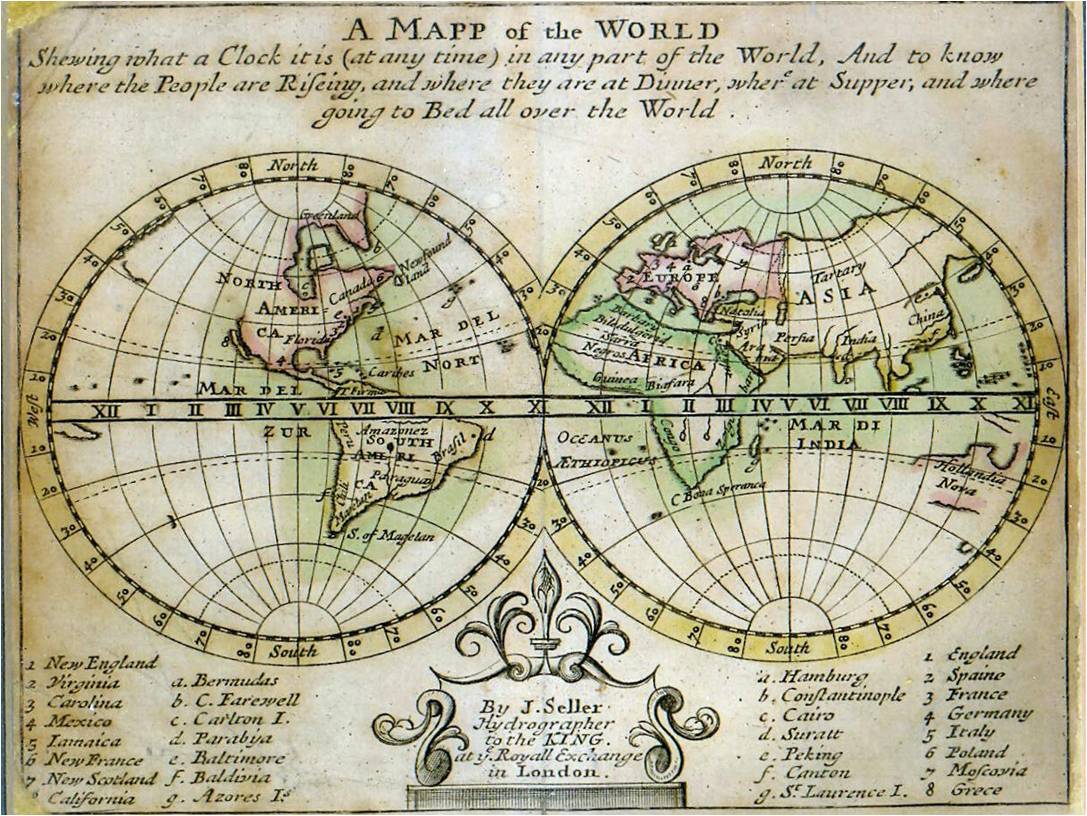
John Seller, A Mapp of the World. [ca.1684]. “A mapp of the world shewing what a clock it is (at any time) in any part of the world, and to know where the people are riseing, and where they are at dinner, where at supper, and where going to bed all over the world”.
“till Seller fell into it we had very few draughts, even of our own coasts, printed in England, but all our English masters, even upon our own coasts, as well as elsewhere, sailed by the Waggener printed by the Dutch”
This is the essential point: “we must see no further than their books direct us”. This was a matter of national strategy and, perhaps the end justifying the means, it worked. As eventually completed by Thornton over twenty years later, with complementary volumes by Seller’s son, Jeremiah, and his most celebrated apprentice, Charles Price, the “English Pilot” became, as Philip Burden says, “one of the great English atlases”. Portions of it remained in use throughout the eighteenth century. Captain Cook navigated the coast of Java by these old charts by Seller and Thornton in 1770 – and praised them.

Greenvile Collins, Great Britain’s Coasting Pilot. 1693. Published by William Fisher’s son-in-law and successor, Richard Mount.
And as to the reservations, well here is Pepys’ own recipe for compiling sea-charts: “The only way ever to do such a thing well, were to have it done by three several persons, severally at the same time … and a committee of persons appointed to sit upon their daily works, and upon comparing them, to conclude what is to be fittest to be taken as good, and where it is needful to have any piece of work done over again”. Pepys of course was ever the bureaucrat – chart-making by committee. A recipe dreamt up in relation to the survey of the British coastline carried out by Captain Greenvile Collins in the 1680s and eventually published in 1693. It could never have been done this way. Pepys had reservations about Collins all along and opposed his being given an official title by Trinity House because this might bring with it “an accountableness for all his mistakes and their consequences”. The cautious bureaucratic reflex again and precisely why it needed the drive and energy of outstanding individuals to make things happen. The King was perhaps more percipient than his advisers in backing both Seller and Collins and giving them his support. Moxon, for all his greater repute, hadn’t delivered the goods – and Seller did.
Seller and Collins did bring to an end the reliance on Dutch material. That was now over. The Collins atlas, like the “English Pilot”, remained in print for a century. Whatever the misgivings of the experts, those who had to rely on these productions – the ship’s masters – liked them and bought them. And theirs is an inescapable voice.

From William Elder, A Coppy Book. [ca.1690].
Let me leave you with something of an epitaph, a little anagram on his name that Seller sometimes attached to his publications: “John Seller – Here’s no ill”.
